

Most students pursuing the Master of Environmental Physics (MEnvPhys) begin with a foundation in physical sciences and a focused interest in Earth’s natural systems. You engage with advanced principles of physics as they apply to atmospheric behavior, landforms, and ecological energy flows. This program equips you with quantitative tools to analyze environmental change, from glacier dynamics to urban heat islands, using real-world data and modeling techniques grounded in empirical science.
Key Takeaways:
- A Master of Environmental Physics integrates core principles of physics with environmental systems, enabling graduates to model complex natural processes such as heat transfer in ecosystems or fluid dynamics in atmospheric and oceanic circulation.
- Programs typically emphasize quantitative analysis and computational modeling, equipping students with skills to interpret satellite data, simulate climate scenarios, or assess renewable energy potential using real-world datasets.
- Fieldwork is a defining component, with students often conducting measurements in diverse environments-from alpine regions to coastal zones-using portable spectrometers, LiDAR units, or microclimate sensors.
- Graduates pursue roles in environmental consultancy, climate research institutes, or governmental agencies, where their ability to apply physical laws to ecological questions supports evidence-based policy and monitoring frameworks.
- The degree serves as a foundation for doctoral research, particularly in interdisciplinary areas such as cryospheric physics, urban heat island mitigation, or the energy balance of forest canopies.
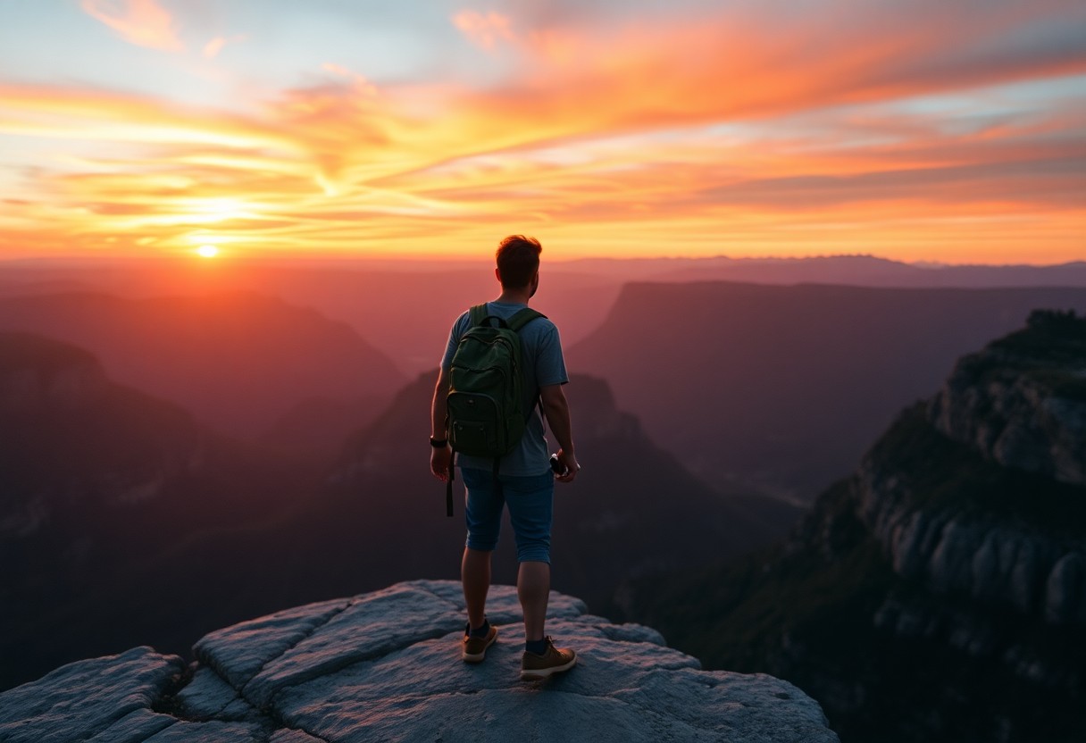
The Scientific Gaze upon the Wilderness
Observing the Unseen Forces
Your fieldwork begins not with instruments, but with silence. Standing at the edge of a boreal forest in early spring, you register the subtle tilt of tree trunks, the asymmetry of snowmelt patterns, the faint hum of groundwater shifting beneath permafrost. These are not passive observations. Each detail feeds into a dynamic model of energy exchange, where thermal gradients shape biological thresholds. A single temperature anomaly in a mountain stream may signal glacial retreat, altering sediment transport and aquatic metabolism downstream. You learn to interpret such signs not as isolated events, but as expressions of physical laws operating across scales.
From Data to Dynamic Understanding
Temperature loggers, LiDAR scans, and isotopic tracers become extensions of your perception. When analyzing a peatland’s methane emissions, you correlate diurnal soil temperature fluctuations with barometric pressure changes, revealing how atmospheric dynamics regulate gas diffusion. A mid-sized SaaS firm might optimize server loads, but you optimize sensor arrays across a 50-hectare wetland, synchronizing readings to the minute. The raw numbers-conductivity, albedo, vapor pressure deficit-coalesce into behavioral patterns of ecosystems under stress. One summer’s data from a Scottish moor showed how prolonged drought reduced evapotranspiration by altering moss layer hydraulics, a shift invisible to satellite imagery but detectable through ground-level flux towers.
The Ethics of Measurement
Your instruments intrude, however minimally. Installing a microclimate station in a remote alpine zone requires helicopter access, leaving a carbon trace even as you study climate change. You confront this paradox directly: the act of measuring alters the measured. Indigenous land stewards in northern Canada have long pointed out that Western science often extracts knowledge without reciprocity. In response, you integrate local observations into your datasets, treating oral histories of river ice breakup as valid temporal markers. This synthesis does not dilute rigor-it expands the observational frame, allowing physics to operate within a broader context of lived experience.
The Curriculum of the Natural Philosopher
Foundations in Physical Earth Systems
Your training begins with an immersion in the physical architecture of the planet, where you dissect the mechanics of atmospheric circulation, hydrological cycles, and geothermal fluxes. You analyze how solar radiation interacts with surface albedo across different biomes, using radiative transfer models to predict local energy budgets. A mid-sized SaaS firm monitoring permafrost thaw might rely on such models to calibrate remote sensing inputs, and your coursework ensures you understand the underlying equations governing those tools. You work with real topographic datasets to simulate runoff patterns in mountainous regions, applying Darcy’s law and the Navier-Stokes equations in practical contexts.
Quantitative Methods in Environmental Observation
Mathematics becomes your primary lens for interpreting environmental change, as you master Fourier transforms to isolate periodic signals in climate data and apply principal component analysis to satellite-derived vegetation indices. You process time-series from polar orbiters to detect anomalies in sea surface temperature, learning to distinguish noise from meaningful trends. One exercise involves reconstructing historical drought intensity in the Sahel using proxy data from tree rings and sediment cores, integrating statistical inference with physical constraints. These methods form the backbone of evidence-based environmental assessment, and your proficiency determines the reliability of your conclusions.
Field Instrumentation and Sensor Networks
You assemble and deploy microclimate stations equipped with thermistors, pyranometers, and soil moisture probes, configuring them to transmit data via LoRaWAN in remote catchments. Calibration against reference instruments at national observatories teaches you the margins of error inherent in field measurements. A case study from the Andes shows how improperly shielded temperature sensors overestimated warming trends by nearly 1.5°C due to solar loading, a mistake you learn to avoid through proper siting and shielding protocols. Your designs prioritize longevity and autonomy, often powered by small photovoltaic arrays and programmed to enter low-power modes during extended cloud cover.
Interdisciplinary Synthesis and Modeling
Climate models are not built in isolation, and you collaborate with ecologists and hydrologists to integrate vegetation dynamics into land-surface schemes. You modify a regional model to include dynamic root water uptake, improving its simulation of dry-season evapotranspiration in tropical forests. The coupling of physical and biological processes reveals feedback loops, such as how reduced transpiration from deforestation alters local convection patterns. Your final project involves simulating the microclimatic impact of urban green corridors in a Mediterranean city, balancing heat mitigation against water use efficiency under projected rainfall reductions.
Laboratories without Walls
Fieldwork as First Principle
Every measurement you take outside the controlled environment of a traditional lab carries the imprint of real-world complexity. A soil conductivity reading in a peat bog reflects not just mineral content but recent rainfall, microbial activity, and seasonal thaw. These variables do not isolate themselves, and your instruments must account for their interplay. You learn to treat entire ecosystems as dynamic experimental setups, where the boundaries shift with weather, time, and biological cycles. A single day’s data from a mountain catchment may reveal patterns no simulation could predict.
Mobile Instrumentation and Real-Time Analysis
Your toolkit extends beyond handheld spectrometers and drone-mounted thermal cameras to include portable mass spectrometers capable of on-site atmospheric sampling. These devices allow you to detect trace gas concentrations in remote wetlands without transporting samples back to campus. A mid-sized SaaS firm developing environmental monitoring software recently integrated such field data into predictive models for methane flux, demonstrating how real-time acquisition strengthens forecasting accuracy. You operate within this evolving ecosystem of mobile science, where decisions in the field depend on immediate analytical feedback.
Collaborative Observation Networks
Scientists across Scandinavia have synchronized permafrost monitoring using standardized sensor arrays deployed along latitudinal gradients. Your participation in such networks means your data contributes to continental-scale assessments of ground ice stability. These collaborations rely on shared protocols and open-access repositories, ensuring that a temperature anomaly recorded in northern Sweden can be cross-referenced with borehole data from Siberia. You are not collecting isolated points but nodes in a distributed observational web.
Adapting to Environmental Extremes
Equipment failure in subzero conditions is not a hypothetical risk but a recurring challenge. You develop workarounds for battery drain in Arctic field camps, often insulating power units with locally available materials. One research team in Greenland modified commercial GPS units with custom housings to withstand prolonged exposure to freezing fog, extending deployment duration by three weeks. These improvisations become part of your technical repertoire, blending engineering pragmatism with scientific rigor.
The Vocation of the Environmental Physicist
A Calling Rooted in Observation
Observation forms the foundation of your work as an environmental physicist, where subtle shifts in temperature gradients or atmospheric pressure patterns reveal larger systemic behaviors. You interpret satellite thermal imaging to detect urban heat island effects, comparing seasonal anomalies across metropolitan regions. Instruments deployed in boreal forests measure longwave radiation absorption, providing raw data that informs climate models. Your role is not to advocate, but to measure, quantify, and report with precision, allowing policy and public understanding to follow from evidence. A mid-sized SaaS firm may optimize server loads, but you optimize sensor arrays to capture the faint signals of environmental change.
Interpreting Nature’s Equations
Equations govern the transfer of energy through ecosystems, and your fluency in them allows translation of natural phenomena into actionable insight. You apply the Stefan-Boltzmann law to assess radiative emissions from deforested land, contrasting them with intact canopy zones. When analyzing oceanic upwelling events, you rely on fluid dynamics to predict nutrient dispersion and its cascading effects on marine productivity. These calculations do not exist in abstraction. They feed into early warning systems for coastal communities facing altered fishery yields. Your computations ground speculation in physical law, offering clarity where uncertainty once prevailed.
Education as a Field Instrument
Advanced training sharpens your ability to design experiments that withstand scrutiny in both academic and applied settings. At institutions like the Home | Masters of the Environment, interdisciplinary coursework merges atmospheric science with policy analysis, preparing you to communicate findings beyond peer-reviewed journals. You learn to present spectral reflectance data in ways that city planners can use to redesign green spaces for maximum albedo effect. Case studies on permafrost degradation are paired with stakeholder negotiation exercises, ensuring your expertise serves not just knowledge, but adaptation. The curriculum treats communication as a technical skill, as necessary as calibration or statistical validation.
Service Through Precision
Public agencies rely on your assessments when drafting air quality regulations or evaluating renewable energy infrastructure. You might model particulate dispersion from industrial zones, using Lagrangian particle dispersion frameworks to simulate plume behavior under variable wind shear. Your reports inform decisions that affect millions, from school outdoor activity policies to the placement of wind farms. Unlike theoretical physicists who explore distant galaxies, your domain is immediate and tangible-the air above a city, the thermal profile of a river, the conductivity of thawing soil. Each measurement carries weight because it shapes responses to real-world constraints.
The Rigors of the Scholarly Pursuit
Advanced Quantitative Reasoning
Complex environmental systems demand a strong foundation in mathematical modeling and data interpretation. You will routinely apply partial differential equations to simulate heat transfer in soil profiles or fluid dynamics in atmospheric boundary layers. A typical assignment might involve reconstructing historical temperature gradients from borehole data using inverse modeling techniques, requiring both numerical precision and an understanding of geothermal assumptions. Mastery of tools such as MATLAB or Python libraries for scientific computing becomes second nature through repeated application across coursework and independent projects.
Original Research Under Field Constraints
Fieldwork often unfolds under unpredictable conditions, where equipment fails and weather disrupts schedules. You may spend weeks collecting microclimate data in a peatland reserve only to discover sensor drift compromising part of the dataset. Addressing such issues requires not only technical recalibration but also methodological rigor in documenting anomalies and adjusting hypotheses. One student’s thesis on permafrost thaw in the Scottish Highlands incorporated repeated ground-penetrating radar surveys, each adjusted for seasonal moisture variation, to produce a three-year subsidence model accepted for peer review in a regional environmental journal.
Interdisciplinary Synthesis
Environmental physics sits at the intersection of geophysics, climatology, and ecology, requiring you to interpret data through multiple disciplinary lenses. When analyzing satellite-derived land surface temperatures, you must account for atmospheric interference, surface emissivity variations, and land cover changes detected in parallel ecological surveys. A project examining urban heat islands in a mid-sized SaaS firm’s campus expansion zone integrated thermal imagery with traffic flow and vegetation density data, demonstrating how built environments alter local energy budgets in ways pure meteorology might overlook.
Thesis Development and Defense
Your final thesis represents the culmination of two years of sustained inquiry, typically spanning 80 to 120 pages of original analysis, figures, and contextual discussion. You are expected to identify a research gap, justify its significance within current scientific discourse, and defend methodological choices before a panel of faculty and external reviewers. Recent theses have included spectral analysis of glacier albedo decline in the Alps and stochastic modeling of coastal erosion under variable wave energy regimes, both requiring extensive validation against observational datasets and sensitivity testing across multiple parameters.
Global Perspectives on Terrestrial Health
Monitoring Ecosystem Vitality through Physical Indicators
You interpret shifts in land surface temperature using satellite-derived thermal infrared data to detect early signs of ecosystem stress in arid regions. Changes in albedo across boreal forests reveal feedback loops tied to snow cover duration and wildfire frequency. Soil moisture gradients, measured via microwave remote sensing, inform drought resilience models used by agricultural planners in sub-Saharan Africa. These physical metrics offer objective baselines, independent of species-level observations, allowing for cross-ecosystem comparisons grounded in energy and mass transfer principles.
Urban Expansion and Land-Use Thermodynamics
Surface energy balance models expose how metropolitan growth alters regional climate patterns through increased heat retention and reduced evapotranspiration. In a mid-sized SaaS firm’s sustainability division, environmental physicists applied urban heat island coefficients to optimize green roof placement, reducing peak building cooling loads by synchronizing vegetation indices with local wind flow data. The integration of land cover classification with thermal emissivity maps enables precise quantification of anthropogenic heat contributions in rapidly expanding Southeast Asian cities.
Permafrost Degradation and Subsurface Energy Flux
Thermal conductivity measurements in Arctic tundra reveal accelerating heat penetration into once-stable frozen ground, with implications for infrastructure stability and greenhouse gas release. Borehole temperature profiles from northern Scandinavia show a deepening active layer, advancing at rates observable over decadal intervals. You apply Fourier’s law to model conductive heat transfer through heterogeneous soil columns, incorporating latent heat effects during phase change. These calculations support predictive frameworks used in designing adaptive foundations for remote research stations.
Deforestation and Radiative Forcing at Regional Scales
Clearing tropical rainforest alters not only carbon storage but also the partitioning of incoming solar radiation between sensible and latent heat. You analyze eddy covariance tower data to quantify changes in surface roughness and boundary layer development following canopy removal. In the Amazon basin, post-deforestation landscapes exhibit higher daytime surface temperatures and reduced convective cloud formation, disrupting local precipitation cycles. These dynamics are captured through radiative transfer models that link land cover change directly to atmospheric stability metrics.
To wrap up
You pursue the Master of Environmental Physics (MEnvPhys) to align deep scientific inquiry with planetary-scale challenges. Your training integrates advanced physical principles with real-world environmental systems, preparing you to analyze phenomena from atmospheric turbulence to subsurface fluid dynamics. Graduates from a mid-sized SaaS firm focused on climate modeling have transitioned into specialized roles requiring precise data interpretation and computational rigor. You engage not just with equations but with ecosystems shaped by physical laws. The degree equips you with a distinct analytical lens, one grounded in measurement, theory, and field validation across diverse terrains and climates.